 |
| We visit Park Avenue, (but in Arches, Utah)! |
What follows is a sampling of these parks.

It is best known for those formations that provide it's name.


Driving through the park, you can see a variety of arches in the distance. They are Mother Nature's artwork and are beautiful to look at. They are also fragile and temporary, in spite of the fact they are made of rock. Wind and rain erode the rock into caves and then create windows in the wall. As long as there is wind and rain, the erosion process will continue until those we can see today will be gone. But by then, new ones will be created.
 |
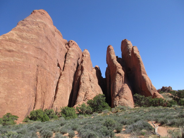
| Future arches? |
The walk to Windows Arches involved an uphill walk along a paved path, but it was worth it.

As I walked up the path to the Windows Arches I could only see one 'window'.
When I rounded the corner at the top I suddenly saw two arches, side by side.
 |
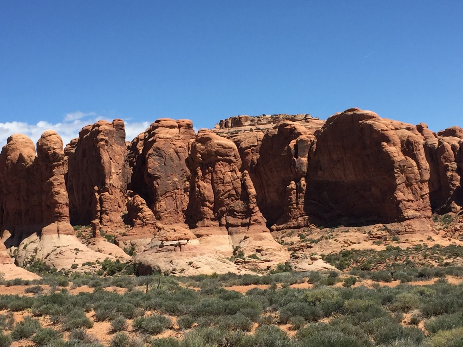
| Windows Arches |
When I turned around I realized the third window, Turret Arch, was to my back.
 |
| Turret Arch |
Delicate Arch is a three mile walk. I had no intentions of going off by myself for that long. but I didn't have to. It can be seen from a distance from a viewing point not far from the road. Larry and I both walked to that lookout point. It is one of the iconic arches in the park.
 |
| Delicate Arch |
 |
| Delicate Arch Sign |
Kids would love it. I was happy I did it, but would have been happy to skip the deep sand.

Once inside a beautiful arch was revealed. (The picture below reminds me of a kissing dog. Am I seeing things?)
 |
| Sand Dunes Arch |

Leaving Sand Dune arch I took a path towards Broken Arch, which was quite a ways away. Fortunately, it led to a viewing spot where I could see Broken Arch from a distance.


If you look closely you can see a dip in the top of the arch that looks like a crack, hence its name.
The arches are not the only fascinating formations in the park. Driving through the park there was so much more to see.


The Three Gossips.


This formation was called Sheep Rock. At first we didn't see it, but then as the road changed direction and we saw it from a different angle, it was clear. Then we saw the rest of the story. Below, is Sheep Rock next to a break in the wall. It is assumed that the rock on the ground was once part of an arch that collapsed. You can see the upside down arch quite well in the picture above.


This was my first visit to Arches. My daughter came here many years ago and raved about it. Since then, it has been on my Must-Do list.
Arches had interesting formations, but the landscape was softer, less dramatic, than Bryce. In Arches I was as interested in the formations, as the landscape.

After Arches we visited Bryce. Bryce is a short drive around the rim of a canyon, but has some of the most beautiful sandstone formations.
Driving into Bryce we went through the Red Canyon.

I love the little tree at the very top of this rock. (Not the big, visible tree. There's a little one up there!)


Bryce is dramatic with deep canyons, jagged cliff formations, arches and pillars.


While Bryce is a drive around the top of the canyon, Zion is the only park in which we drove around the bottom of a canyon. Instead of looking down on delicate sandstone formations, we were looking up at towering rock walls. Instead of all this desert scenery we've been seeing, Zion was a lush paradise carved out by the Virgin River.
I was advised to visit the Narrows at the end of the park. It is a slot canyon that can be walked in when the water is low. Since it was spring, it was closed due to high water melt off. Oh well. The rest of the park was gorgeous. It was a nice change being at the bottom and able to enjoy the lushness.

 |
| Waiting to go through the tunnel |
 |
| View through the tunnel window. |
We parked in town, and took the shuttle to the town drop off.. Then we crossed the bridge to the park entrance. From there we used the park shuttle bus which stopped at all the designated stops on the map. Had we been there a few weeks earlier, we could have driven ourselves. But most viewing stops have few parking spaces.The shuttle was very convenient and another bus came along every ten minutes.
The first stop along the route was at the Patriarchs.


We walked up the hill to the best viewing of the Patriarchs, and discovered a distant waterfall.

When we arrived at the lodge, I knew I wanted to walk out to the Emerald Pools. The path was smooth, level, and with only some incline in places. It was about a mile, roundtrip. I left Larry at the lodge, while I took off.
 |
| Zion Lodge. There were people everywhere, enjoying the sun, moderate temps, and green grass. |

I expected to come out at a pool, but that was the longer trail. The pools were at the top. Instead I came out at the bottom of the waterfall. I'm happy I did. It was a perfect walk and I had this view!
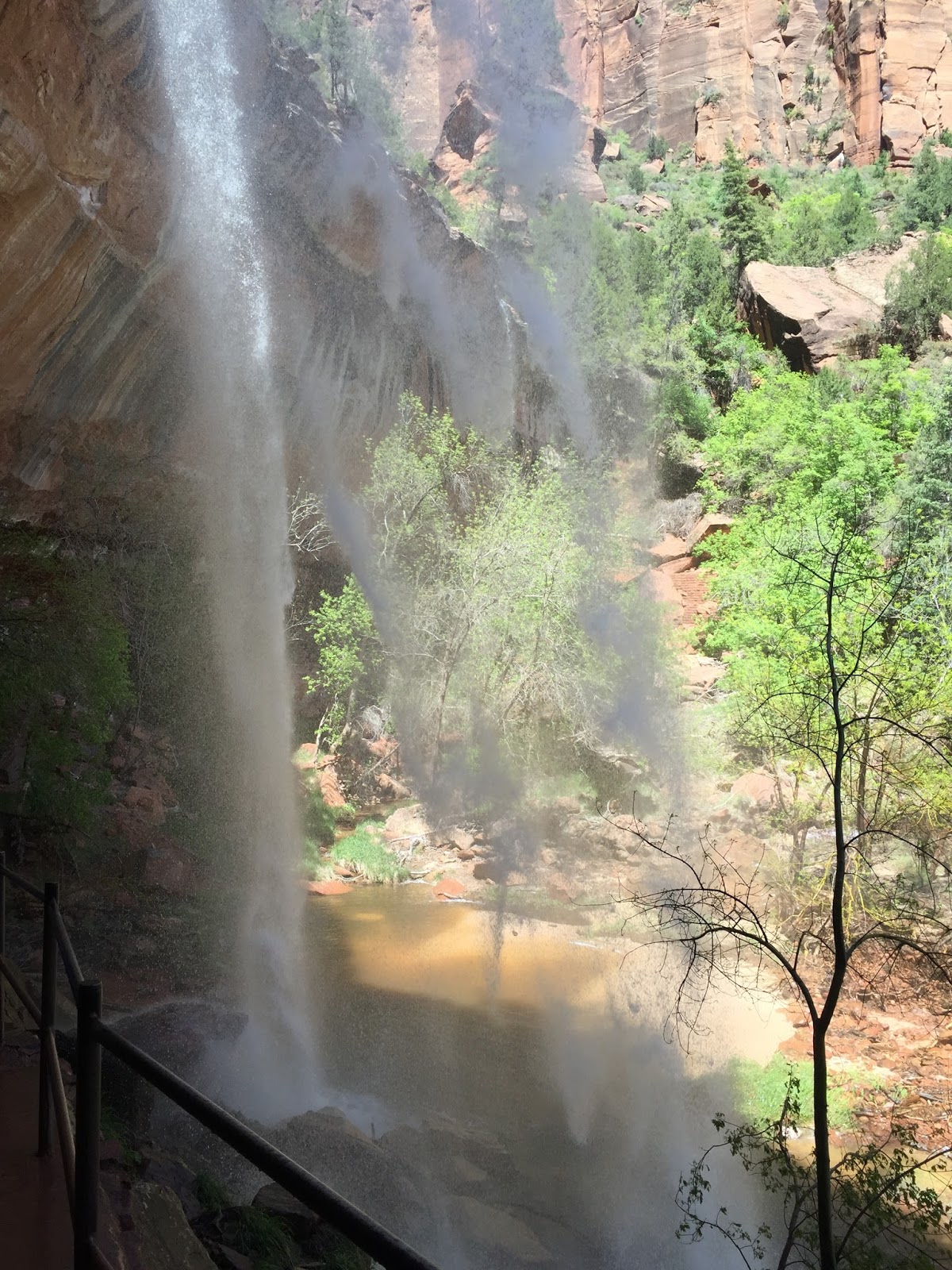
I hope this video of the waterfall loads properly. It's the first time I've tried including a video in my blog posts.
 |
| The bridge back to the lodge. I wasn't alone out there, and its early in the season. |
Another place I walked to was the Weeping Rock. It was a short, but steep path. This rock is always wet, and has plants growing along it's wall.
 |
| Looking out from the overhang at the cliffs above |

 |
| Vegetation growing from the cliff walls, fed by the constant drip of water |

The end of the road in Zion was the Riverside walk. The Virgin River enters the canyon at this point, and in low water times, people can walk back through a slot canyon called the Narrows. It was closed when we were there, but the rest was so pretty, we hardly cared.


It was about this time that I wrote my Scenery Saturation post. We had seen so many beautiful sights that I was just full. I could hardly absorb any more. But there was still more to see. In my next post I will share some of the lesser known places we went to.


I can't wait to go back to Zion and Bryce with Steve! I loved both parks, but we visited in early December. Things looks a lot different with a dusting of snow on it. Also, we drove through/around Zion (no shuttles in winter) which was really gorgeous and surprisingly warm for a December day. Your photos brought back so many memories! Enjoy your travels!
ReplyDeleteThanks Susan. It's been a fabulous trip. I bet it was beautiful with snow, but the green certainly is lovely.
DeleteThis comment has been removed by the author.
ReplyDelete