Showing posts with label Mt. Rushmore. Show all posts

Friday, September 2, 2016

South Dakota: Badlands, Deadwood and the Presidents


The slogan for the National Park system, that is celebrating 100 years this year, is Find Your Park. We traveled through 21 states on our RV trip and visited at least 12 national parks and monuments! The big finish of our western tour was in South Dakota. We camped in Rapid City for a few days and spent three days checking out the sights. (By this time I needed a laundry and cleanup day, so we stayed one extra day just to take care of household chores.)

South Dakota isn't as awe-inspiring as Utah, but the corner we were in had some amazing places and beautiful sights, from wildflowers by a stream,


to rugged, barren rock.

We spent one day driving through the Badlands, and ending at a well-known tourist spot, Wall Drug.

The story behind Wall Drug was unknown to me. I am always in search of inspiring stores, so I found this one very interesting.

The town of Wall, SD is so-named because it lies at the base of rocky cliffs that rise from the prairie like a wall.

The Husteads moved there in 1931 hoping to make a go of running a drug store. Business was slow, but they hoped when Mt. Rushmore opened business would boom. Unfortunately, it didn't. 5 years later they were listening to the cars on the highway driving right by, without stopping in town. One afternoon, Dorothy had an idea---to advertise free ice water. They put signs on the highway, like the little Burma Shave signs, that directed people to Wall Drug for a FREE glass of ice water.

They've been busy ever since and they still offer free ice water. The drug store has grown way beyond it's original size. Once inside the 76,000 square foot complex there are many smaller stores selling everything from t-shirts to lovely paintings.
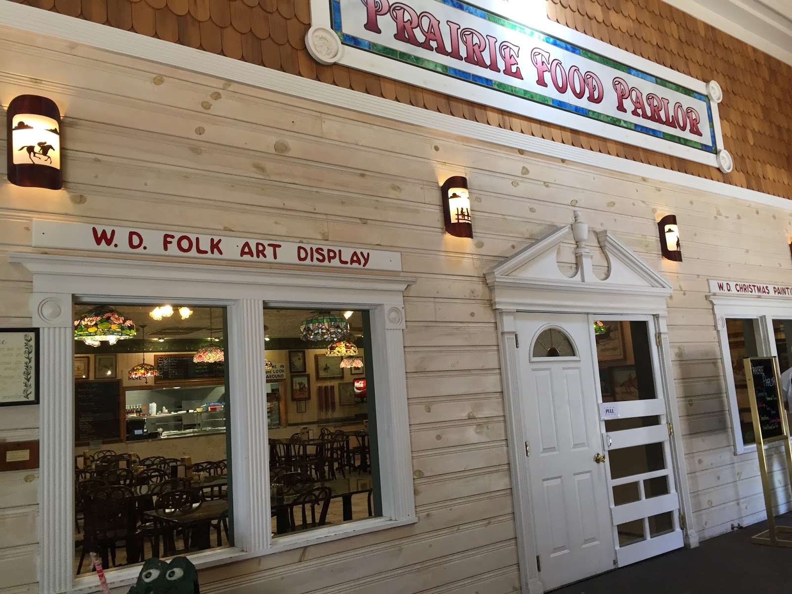

A restaurant, arcade, and a chapel for those needing a quiet respite, are just a few of the things you will find there.


Wall, SD is at the western end of the Badlands. I've always heard about the Badlands but I had never been there so I was intrigued. In truth, I've seen many places on this trip that would be most intimidating to me as a traveler in the 1800's. The name came from the Lakota people who called this area, "Mako Sica", which translated, meant Land Bad. And if I had to travel through here on horseback or wagon, I would have agreed!

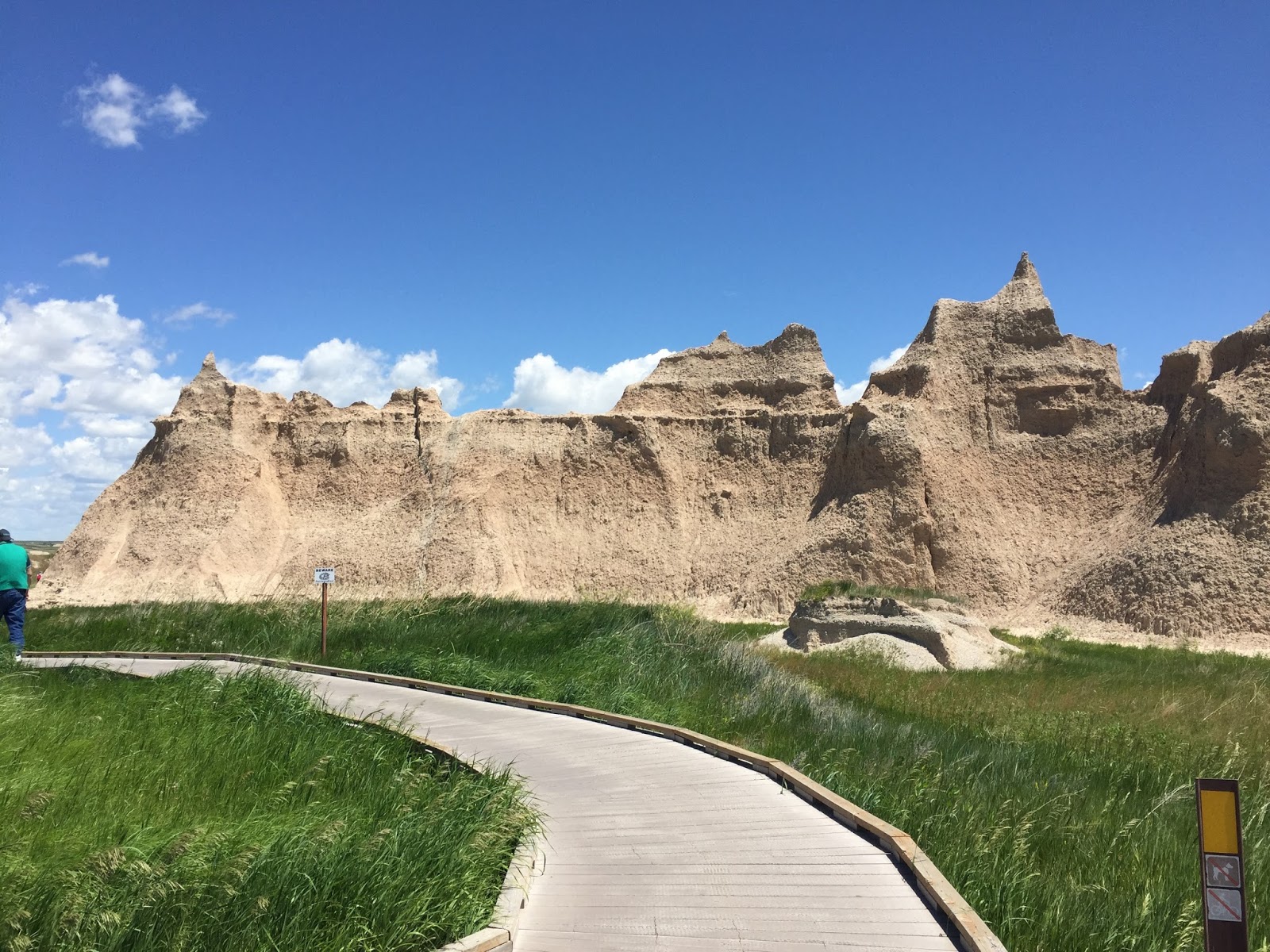
These formations looked like sand castles.
As we drove through the Badlands, we were able to see the beauty. I doubt the pioneers had the same perspective, though.


 During the day the colors are rather muted, but the rocks almost glow and the colors are beautiful in early or late day when the sun is low in the sky.


The second day we were in Rapid City, we took the northern route and traveled up to Deadwood, a reinvented ghost town.


Deadwood was originally a mining town that stood along a creek. I am always intrigued by the names of developments that spring up today, with names like "Cypress Creek", or "Whispering Pines" (where there is no creek to be found and any tree that existed has long since been removed in order to build homes). The name Deadwood derives not from someone's imagination, but because the gulch where gold was found was lined with dead trees. Miners in search of gold would know right away they had found the right area when they saw all the dead wood. The hills come right down to the creek's edge and the town simply climbed its sides. The town had one of the most productive gold mines for over 100 years. In the 1980's as the town store fronts lay vacant the residents decided to redefine the town. Town promoters were able to get a state constitutional amendment that allowed limited stakes gambling. Many of the old saloons have been rebuilt and refurbished to be saloons with casinos. To further celebrate their history, they reenact gun fights daily and hold frontier celebrations throughout the year.


On our last day in this area we drove the scenic routes around Mt. Rushmore, which is located just outside Rapid City. The Peter Norbeck National Scenic Byway, which includes Iron Mountain Road and Needles Highway, forms a loop that grants views of Mt. Rushmore and encompasses some of the most awe-inspiring vistas. Probably the most creative and unsuual road we've ever driven was the Peter Norbeck National Scenic Byway. As described in its website, "South Dakota conservationist, Governor and U.S. Senator Peter Norbeck wanted to share the unspoiled beauty of the Black Hills with others. But it was of utmost importance to him to do it responsibly. The result is a 68-mile series of twisting roads that carefully tiptoe through the Harney Range of the central Black Hills, leaving very little impact on the surrounding environment. You won’t find a comparable scenic byway anywhere else in the country because Peter Norbeck was the only person bold enough to challenge the engineers of the time who said it couldn’t be done."

The byway is full of narrow, tight turns and tunnels through the mountain. Among Norbeck's achievements in developing this road was the alignment of three one-lane tunnels through the mountain so that they were positioned to give the traveler a clear view of Mt. Rushmore.
Coming through this tunnel, Mt. Rushmore can be viewed through the trees.
Same view as above.

Norbeck was also known for designing 'Pigtail' bridges, in which the road looped over itself.

From the scenic byway, the road continues on to the Iron Mountain Road, and then loops around Custer National Park. The end of the loop drive is through the Needles region, which showcases tall spires and columns of rock.


One of the tunnels just fits a full size tourist bus. The tunnel is 8'4" wide. The bus is 8' wide! We were behind one bus as it approached the tunnel and I was hoping to see it as it squeezed through the tunnel. However, the driver pulled over to let the line of traffic behind him, through first. The next day I spoke with a woman who had been on the bus and she described the driver as he hammed it up for the cameras, holding up a bottle of maalox and a sign that said Learner Driver. Two videos on YouTube show this unique drive. The first one ,3 minutes long, is a nice view of Needles area. The second one shows the bus growing through the tunnel. It is 8 minutes long, but fun to watch.

It was this area that was the original brainstorm of Mt. Rushmore. A local historian, Doane Robinson, had the idea of carving Wild West heroes into the tall granite columns as a tourist attraction. However, when the sculptor, Gutzon Borglum, inspected the rocks he said they were too fragile for such an undertaking. At the time, Borglum was working on Stone Mountain in Georgia. He believed that the project should be grander than Robinson's vision. He wanted to create a shrine to democracy and presented the idea of the Presidents. After exploring the area he settled on Mt. Rushmore as having the right type of rock and the best viewing. He chose Washington as the father of the country. Jefferson represented growth because when he purchased the Louisiana Territory it doubled the size of our country. Lincoln preserved the union (because he fought to keep it whole), and Roosevelt represented its conservation and development.

View of Washington's profile from the Needles Highway

At the end of this remarkable drive, we visited Mt. Rushmore.


A path goes from the amphitheater, to the base of the monument, affording a variety of different views. It continues on past the sculptor's studio, which was closed when we were there.


We visited as the sun was setting and stayed for the evening program. Every night, a program presents the history of the National Monument and tells about its creation. The faces are lit by floodlights, and all servicemen, retired or active, are invited onto the stage where they are introduced by name, and branch of service. It is a wonderful way to honor those who have stood for the liberty we have been blessed with.

We had an amazing time in South Dakota. We saw a lot, and yet there is so much more there to see. In fact, that pretty well sums up our whole trip. We saw so much of this wonderful country, but we only took in a fraction of what was there. Aside from the history of our own people, I became so much more aware of the history of the original North Americans. The Native American heritage is woven through the history of every state in our country and we were reminded of that.

Find My Park? Well, let's just say we found a bunch of them! Thank you Teddy Roosevelt, and all of the other forward thinking preservationists that recognized "We do not inherit the earth from our ancestors, we borrow it from our children". (Unknown)

"Leave it as it is, the ages have been at work on it, and man can only mar it." Teddy Roosevelt

Saturday, June 13, 2015

The Roadtrip Begins: Denali and the Interior


Cruise Journal Continues:

After a week on a ship, it was time to move from water to land and get to see Alaska's Interior.
The ship docked in Seward and we boarded a bus to Anchorage, where we would pick up a rental car at the airport. The "Planned Tour" was over. We were ready to head out on our own and explore the mainland!

On the way to the airport, our driver took the back road into the airport where moose are often seen. Sure enough, there was a female grazing in a field right off the road in the back of the airport. I have to hand it to the driver. Some of the people on our ship were flying home rather than continuing on. That was a special moment for them. I have been to Anchorage before, and one time as I drove that same road, I came by a moose grazing along the shoulder. He was gorgeous. It has always been one of my favorite memories. I wasn't able to get a photo of this moose from my vantage point in the bus which was too bad, because it was the best sighting we had. Later on I saw a moose and newborn calf, which was a real treat, but they were very well hidden in the brush.

An interesting piece of Trivia.... I think Anchorage is the only city in the U.S. that has a registered population of Moose, Grizzly Bear, and Black Bear in the city limits. Fun place to live....(or not?)! I guess it depends on how much you enjoy checking your backyard for wildlife before putting the trash out or getting the mail!

Anyway.... on to the trip.

A Day of Highs and Lows

We spent the night in this bed and breakfast in the Wasilla/Palmer area. The mountains were drizzled in white frosting against another "forget-me-not blue" sky.


The next morning we headed north towards Denali National Park, home to Mt. McKinley, the highest peak in North America. It is often hard to see, because it usually has it's head in the clouds. Along with seeing whales, seeing Mt. McKinley, or Denali as the locals call it, was on my MUST SEE list. I've been to Anchorage twice and on a clear day it can be seen from there. I've never had a clear day in Anchorage.

As we headed north on Highway 3 the sky was incredibly blue and clear. We rounded a curve at Trapper Creek and there she was...straight ahead, clear as a bell.

1st View of Mt. McKinley from the highway
The south face of Denali's white, snow-covered peaks rose above the trees that lined the road. It glowed in the sunshine. I was in awe. It was just a beautiful sight, and it was easily 50 miles away.
Mt.McKinley seen from the South
We saw it several times as we drove north and it was more majestic each time. There are two peaks to Denali but from the south you see the south peak. The north peak is mostly behind it.

Mt. McKinley seen from the East
Driving north, our eyes were peeled to the sky, constantly searching for the next view. As we traveled we were able to see the different faces of it. When it was to our west we could easily see the two peaks. The south summit was conquered first and is the one most climbers attempt.  Once we were inside the park we had a very different view. From this vantage point we had a better concept of the challenges facing mountain climbers.

Mt. McKinley seen from the North...view inside Denali National Park

The park view looks quite different from the southern view, but it is unmistakable from any vantage point because it is so much bigger than any other mountain and always covered in snow. The skies were hazy here and there were times when the effects of distance caused it to blend in much more with the other mountains.

The mountain has two names and both are registered. It was originally named by a gold prospector in 1896 for then presidential nominee, William McKinley, because McKinley supported the gold standard. The Athabascan natives called the mountain, Denali, meaning "the Big One". Most maps today call it Denali, but the U.S Geographic Registry has it listed as Mt. McKinley. There are attempts to change it officially to Denali, but those attempts haven't been successful, yet.  Clink this link to Read more about Mt. McKinley/Denali.

We stopped for lunch at a Subway outside the park and gassed up before heading in. And suddenly our day took a nose dive into the unexpected, with a phone call from home, 4,000 miles away. Our plans were thrown into a tailspin with the devastating news that Larry's mother had suffered a stroke. With sporadic phone service, and hours from any airport, we were essentially two to three days away if we left then and 36 hours away if everything was timed perfectly. It's a terrible feeling when you want to do something and you know there is nothing you can do. We could sit in the waiting room and wait, or we could wait for word sitting in the car.

Those of you who follow my blog know that I write them one day and then edit several days later. Almost all of my blog posts are posted in retrospect, even though they are written currently. So at this point I can tell you we stayed in Alaska and had multiple daily updates. Initially she stabilized and was moved to a nursing home where she made remarkable progress. We were able to get home to see her before she suffered another stroke, but we kept in touch via lots of phone calls and texts. 

For the time being, we decided to stay put, and continue on with our plans to drive through Denali and wait for more word on how she was doing. So with our minds in two places, thousands of miles apart, we ventured into the park.


Denali Nat'l Park is beautiful, but bleak, or stark in places. Due to the cold winters the tree line is much lower than in the Colorado Rockies. The tundra rises up as far as it can go, and then leaves the granite peaks to reach into the sky unclothed. It was still early summer/late spring, before the ground cover had begun to bud.


In the lower valleys the birches were in new leaf and the light green was a contrast in relief with the dark green of the spruce.


In the higher elevations the snow still lined the mountain valleys, and ice shelves were still prominent along mountain streams.

Our visit was timed well, because during our two day visit we were still able to drive into the park to Mile Post 30. On May 20 the park road was cut off to traffic at Mile 15. From there, people had to board buses if they wanted to go any further.

As we drove through the park we found ourselves going slowly, searching for wildlife. Binoculars and cameras were at our fingertips as we scanned hillsides, tree tops, ravines for any sign of moose, caribou, bear, eagles, or Dall Sheep. And we were rewarded.

Ptarmigan, Alaska's State Bird, in the brush by the side of the road.

 Dall Sheep on rocky hillsides and outcroppings.


We had a good view of this Caribou in a dry river bed
Caribou were in abundance, if distant. At first it took a sharp eye to pick out the antlers rising above the scrub, or the sand colored hides along rocky river banks, and hillsides. A nice zoom lens was a big help to this amateur photographer!


These caribou had been lying in the brush until one stood up giving us a good view.

A bull Caribou grazing by the side of the road.

Cars or buses stopped along the roadside gave us a heads up that something was there and we would stop and look.

As we drove out of the park several cars were stopped at Savage River so we stopped too. Hard as we tried, we couldn't see anything of interest, so I went up and asked a bus driver if he could see anything. "Sure can," he replied. "Two bear right down there."

I pointed the binoculars in that direction and finally saw two small, round, off-white rumps in the bush along the river. Bear! I pointed them out to Larry and he finally found them too, just as the yearling put his front feet on his mother and rose up for a look around. By the third day in the park we were able to locate and point them out to others, but the eye-mind connection had to really adjust what we were looking for before they were visible to us.


When we went back the next day we saw the same pair crossing the river on the ice shelf.

We pulled away from Savage River and rounded a corner, when all of a sudden, a Mama Bear and two cubs walked casually out of the line of spruce trees right by our car! Larry slammed on the brakes, and grabbed a camera. Snapping a picture, he got her in his side view mirror.

Then he handed me the camera as I rolled down my window.

The three bears stopped by the back of our car and grazed while we snapped away. Larry, in his excitement, yelled at me to "get out and take a picture!" Using some of my more colorful words, I told him I wasn't GETTING OUT of the car!!! But I did get some great shots.

Our first day in Denali ended with us feeling the effects of emotional exhaustion. It had been a day of very big highs, and extremely low lows. But there was one more special moment waiting.

Susan Stevenson and I meet by chance at a rest area outside Denali
For years, I have followed a blog written by fellow blogger, Susan Stevenson, who lives in Fairbanks. We had made plans to meet face-to-face for the first time on Friday in Fairbanks. Now I wasn't sure that would happen. Susan has very long, very red hair, and I knew she had been in the park that day. As we were leaving I saw a woman with long red hair walking to a car in a rest area! It was Susan! Excitedly, I pointed her out to Larry, and we immediately turned around and drove back. It was my final MUST SEE of this trip. All I can say is that God knew my bucket list and covered it on one of the most difficult days we have known.

We headed back to our B & B that was located on a small lake. We were ready to turn in for the night. From our room I watched the setting sun reflected on the hills and welcomed the peace.

The day was done, but this was Alaska in May. There wasn't a lot of night.

Midnight in Alaska in May: I could read in my room using just the light coming in the window!
At midnight the mountains were reflected in the water. As I drifted off to sleep I reflected back on the day. Whatever tomorrow was to bring, I had been blessed.

To God be the Glory. He has graced me far beyond what I deserve.